

Environmental Design and Planning Ph.D. candidate Jiyue Zhao researches the intersection of cities and natural landscapes to increase coastal resilience.
In September 2017, Hurricane Irma slammed into Florida as a Category 4 hurricane. Among the 6.8 million Floridians evacuating their homes was Jiyue Zhao, an urban planner and landscape architect. Her evacuation route led her to Athens, Georgia to stay with a friend.
Now a Ph.D. in Environmental Design and Planning candidate at the College of Environment and Design, Zhao draws from her experience with Hurricane Irma to inspire her doctoral research.
 “It all started from a huge hurricane, Irma,” said Zhao. “That was one of the factors in my decision to apply to this university, and [why] I included hurricanes as one of the topics for my dissertation.”
Zhao, under the instruction of her advisor, Dr. Rosanna Rivero, researches the co-evolution of urban morphology and landscape ecology to enhance coastal resilience and climate adaptation. Urban morphology is the study of how the physical structures of cities change over time, while landscape ecology is the spatial arrangement of ecosystems. Zhao looks at how these two areas of study intersect and change together.
“My goal for this dissertation is to create comprehensive, multi-stage and multi-scale research on this topic,” said Zhao.
Zhao looks at this co-evolution on multiple scales: Long-term, looking at sea level rise, and short-term, looking at the impact of natural disasters like hurricanes and wildfires. Zhao hopes to leverage spatial data on these events to inform more effective conservation strategies, both in the built and natural landscape.
“The most significant part [of] my research is to create a comprehensive framework to measure urban resilience,” said Zhao. “For example, in a neighborhood, we have the data before and after a hurricane… and we can analyze which factor is important during the hurricane to keep the resilience of the neighborhood, and then we can make decisions.”
For her research on sea level rise and hurricanes, Zhao uses data from Chatham County in coastal Georgia and St. Johns County in Florida. In her wildfire research, Zhao looks at data collected from California wildfires.
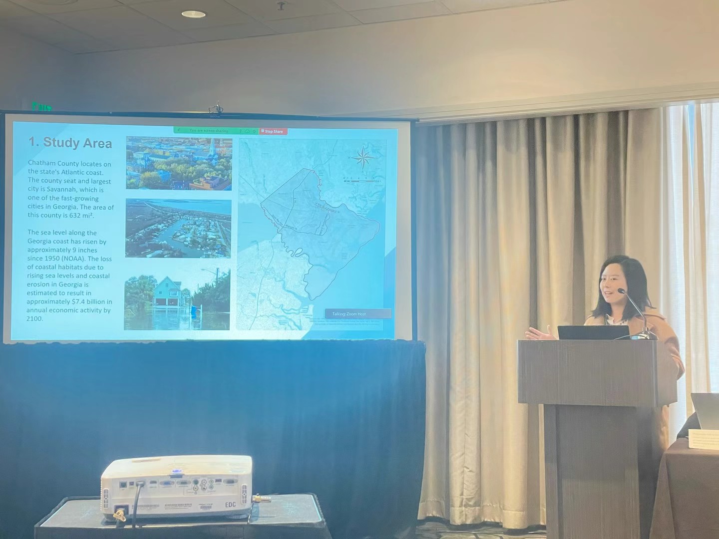
Zhao plans to document her dissertation in three articles. The first article, published in June 2024, looked at the impact of sea level rise in Chatham and St. Johns counties. Using remote sensing technologies, Zhao measured the landscape and urban morphology changes caused by sea level rise for each foot of elevation increase.
After mapping the outcomes, she found that wetlands experienced notable alterations, and the level of fragmentation in urban built areas would progressively increase.
“The city is a very complex system,” said Zhao. “You need to consider the natural environment and human well-being, as they are both part of a complex, interconnected system.”
While the first two articles of her dissertation build on existing research using classical methods, in the third, Zhao seeks to create a set of new metrics that encapsulate a three-dimensional measurement for the urban and landscape system. This set of 3D metrics will provide a more realistic analysis by including the vertical structure into the assessment of the system before and after a natural disaster, by adding elements such as volumetric loss, structural damage and canopy height change.
“It’s not just creating a new way that hasn’t existed,” said Zhao. “It’s about using the classical techniques, state-of-the-art practices and a novel approach I develop.”
Zhao hopes that her research will provide practical solutions to stakeholders in coastal regions, including residents, city officials, economists, and of course, urban planners.
“I was an urban planner and landscape architect back in China,” said Zhao. “At that time, I found some gaps between critical data and communication with stakeholders. This became one of my primary motivations to conduct solid, quantitative studies.”

